Location and management objective:
The Mosaic catchment is located on a tributary of the Agua Salud River and is directly adjacent to the Forest Catchment. It abuts the boundary of Soberania National Park and matches up extremely well with the Forest Catchment in terms of drainage area, geology, original soils, topographic properties, and precipitation (PDF). The management objective is to maintain the vegetation as it is now.
Area: 153 hectares

Vegetation type: The vegetation is a mosaic of predominantly young secondary forest, pasture and land that continues to be managed for subsistence agriculture.
Monitoring:
Hydrology: Regular monitoring includes precipitation rain gage and stream flow
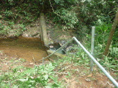
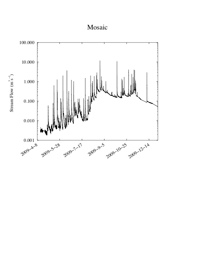
level troll model 300; ISCO model 6712.
Water chemistry: three broad types of water samples are collected: grab samples (stream water, throughfall, overland flow, groundwater), stream-water event samples, and wet-dry collector rainwater samples. Analysis of many dissolved and solid phases including bioactive, major, and trace constituents (PDF).