Location and management objective:
The Cattle Pasture Catchment of the Agua Slaud focal research area is located at the headwaters of a tributary of the Agua Salud River and is contained within the Mosaic Catchment. Most of the pasture is contained within the Agua Salud property boundaries and is managed by agreement with the previous land owner and at the same pre-acquisition intensity. A heard of cattle is rotated between this and another pasture outside the watershed at monthly intervals (approximately 1.3 head of cattle per hectare).
Area: 40 hectare
History: This catchment has been continually managed for cattle for several decades.
Vegetation type: Land cover is predominantly pasture with a low density of fruit and other trees. A small portion of this catchment is currently in young secondary forest.

Monitoring:
Hydrology: precipitation rain gage, stream flow
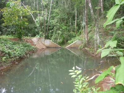
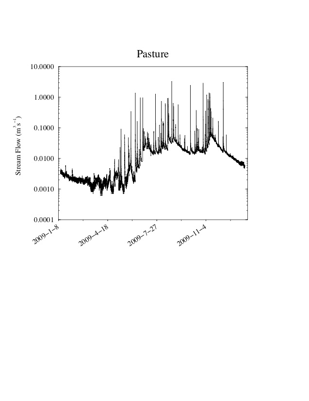
level troll model 300; ISCO model 6712.
Soil: monitoring includes physical characteristics of soil in relation to soil hydrology, and soil carbon
Met station: there is a met station installed and monitored by ACP in the catchment.
Water chemistry: three broad types of water samples are collected: grab samples (stream water, throughfall, overland flow, groundwater), stream-water event samples, and wet-dry collector rainwater samples. Analysis of many dissolved and solid phases including bioactive, major, and trace constituents (PDF).